Wentworth
Falls Walk
A fifty metre high waterfall is the highlight
of this walk, which takes visitors through
regenerating bush.
Directions: From
Whangamata township drive south on SH25 for
2.5km. Turn right off the highway onto Wentworth
Valley Road. The track starts at the road
end.
Time: 2 hours return
Tip:
There is a campground at the start of the
track for those wanting to overnight in this
beautiful valley
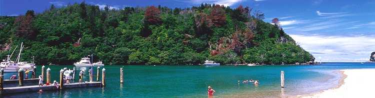
Opoutere Beach
A great area for bird watching enthusiasts as at the southern end
of the beach the Wharekawa harbour Wildlife Refuge protects a breeding area for New
Zealand dotterel and the variable oyster catcher.
Directions: From Whangamata drive
north on SH25 for 11kms until you reach the turnoff to Opotuere. The carpark to access the
walk is approximately 4kms from the turnoff. The track starts by crossing a wooden footbridge
and following a track through well-established pine trees. On reaching the beach turn right
and walk along the shore. After approximately 500m, a boarded walkway crosses the sandspit. If
it is low tide walkers can follw the estuary most of the way back to the carpark.
Time: 45mins return
Parakiwai Valley (Wharekirauponga)
This walk follows the old lower tramway track
through a 20m tunnel and offers a number of old gold mining relics and a stunning waterfall at
the end. There are a number of smaller walks which branch off the main walking track. It is
recommended that you stay on the main track.
Directions: From Whangamata
township drive south on SH25 for 6km. Turn right off the highway onto Parakiwai Quarry Road.
The track starts at the far end of the car park, which is at the road end a further 2.5km
Time: 3 hours return
Tip: Sections of this walk are
not well marked, after approx 30 minutes, two orange triangles indicate the track bearing to
the left.
Waimama Bay Walk
This well formed track will take you through bush
and around farmland before descending into a beautiful bay. A great place for exploring rock
pools.
Directions: This walk starts from
the northern end of Whiritoa Beach, across the stream. Whiritoa is 13km south of Whangamata.
Turn left onto Whiritoa Beach Road, at the end turn left onto Kon Tiki Road and follow this
till you reach the reserve at the end. Beach access is available here and the start of the
walk is just to the left along the beach.
Time: 1 hours return
Luck at Last Mine
A well sign posted track in the forest provides a
scenic walk to old gold mine ruins where you can view old mining relics.
Directions: 7
km north of Whangamata, just past the Onemana Turn off, turn left onto Taungatara Road and
continue 3km along the road till just before the first concrete river crossing. Parking is on
the right, and the track starts on the left.
At first winding through a scrubby
harvested forest landscape the initially unformed track soon descends to the old level
carriage way bounded by native trees and the Wharekawa stream. Some 50-60 minutes from the car
park the track leads over a bridge then to the right, and, after a short distance to the first
view of the battery site.
Time: 2 hours return
Tip: Old mine workings can be dangerous
– please take extreme care
Pokohino Beach
This
small secluded beach offers a warm sheltered sandy bay with plenty of shade under ancient
Pohutukawas. At low tide a natural tunnel through the cliff gives access to a small rocky
cove.
There is
good fishing from the rocks to the right of the beach and safe swimming in the bay.
Directions: 6 kilometres north of
Whangamata on SH25 take the right turn into Onemana. 1.5km down the road into Onemana, take a
left turn onto Pokohino Road, first road passed Normans Access Road. Follow this road
for 4 kilometres till you reach the carpark. The track starts here.
Time: 20 minutes one-way
Tip: Pokohino
Road is a forestry road, please have your lights on at all times and watch for logging trucks.
This is a steep track in parts, take care.
 previous page
  back to home page